


Chapter 2: Rivers Run Throughout
Nationally and internationally consequential rivers, including the Ohio and the Mississippi, adjoin Illinois, and a multitude of streams and tributaries traverse it, influencing local and regional ecosystems and economies. The role of rivers as catalysts for change in rural Illinois proved to be a recurring theme among the companion exhibitions and programs produced by the organizations that hosted Crossroads: Change in Rural America during its sojourn in our state.
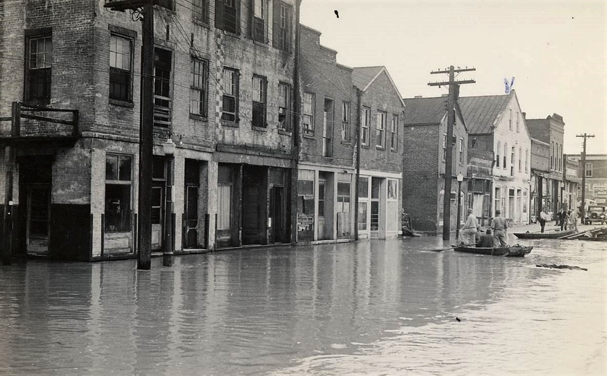
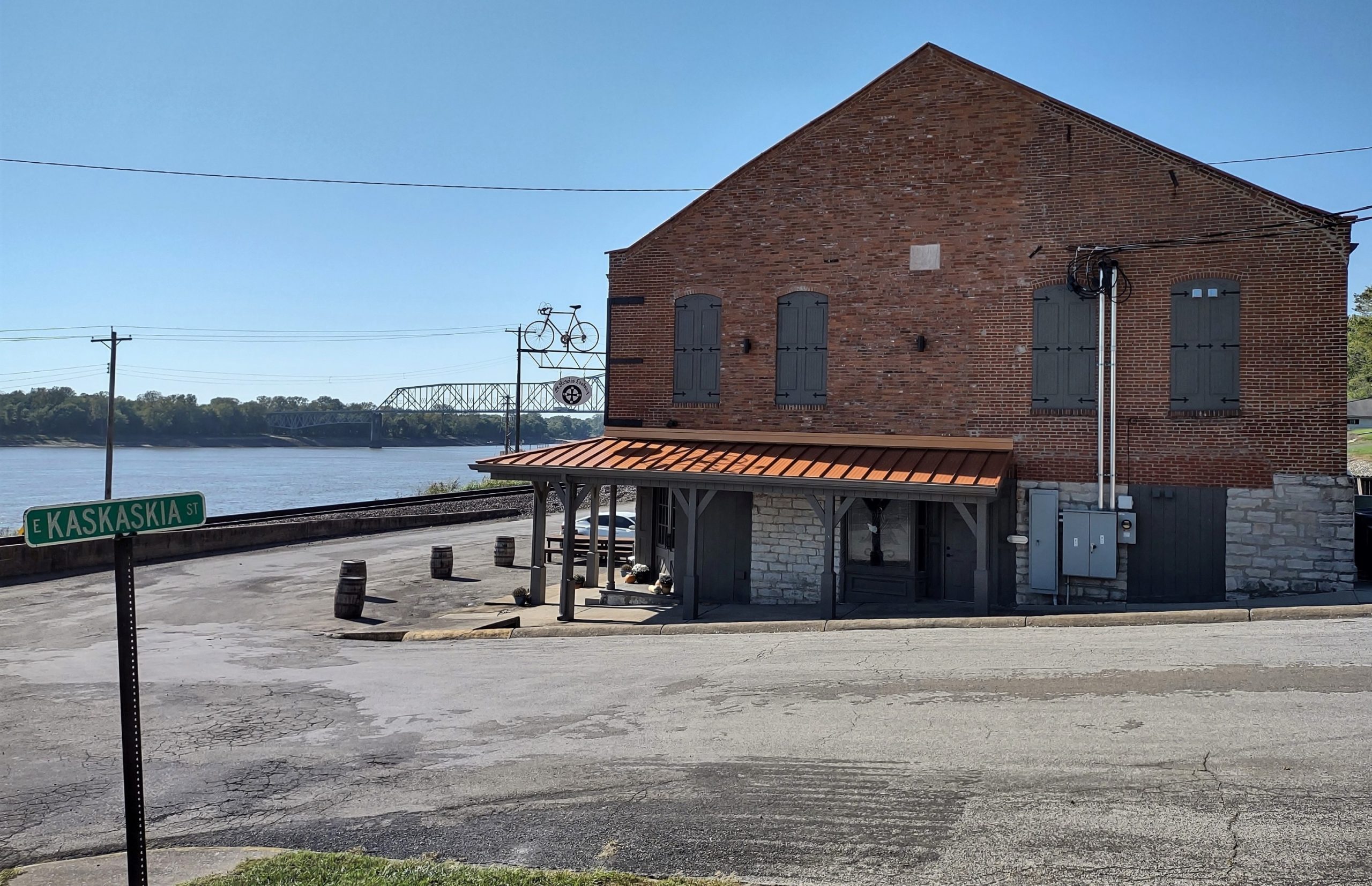
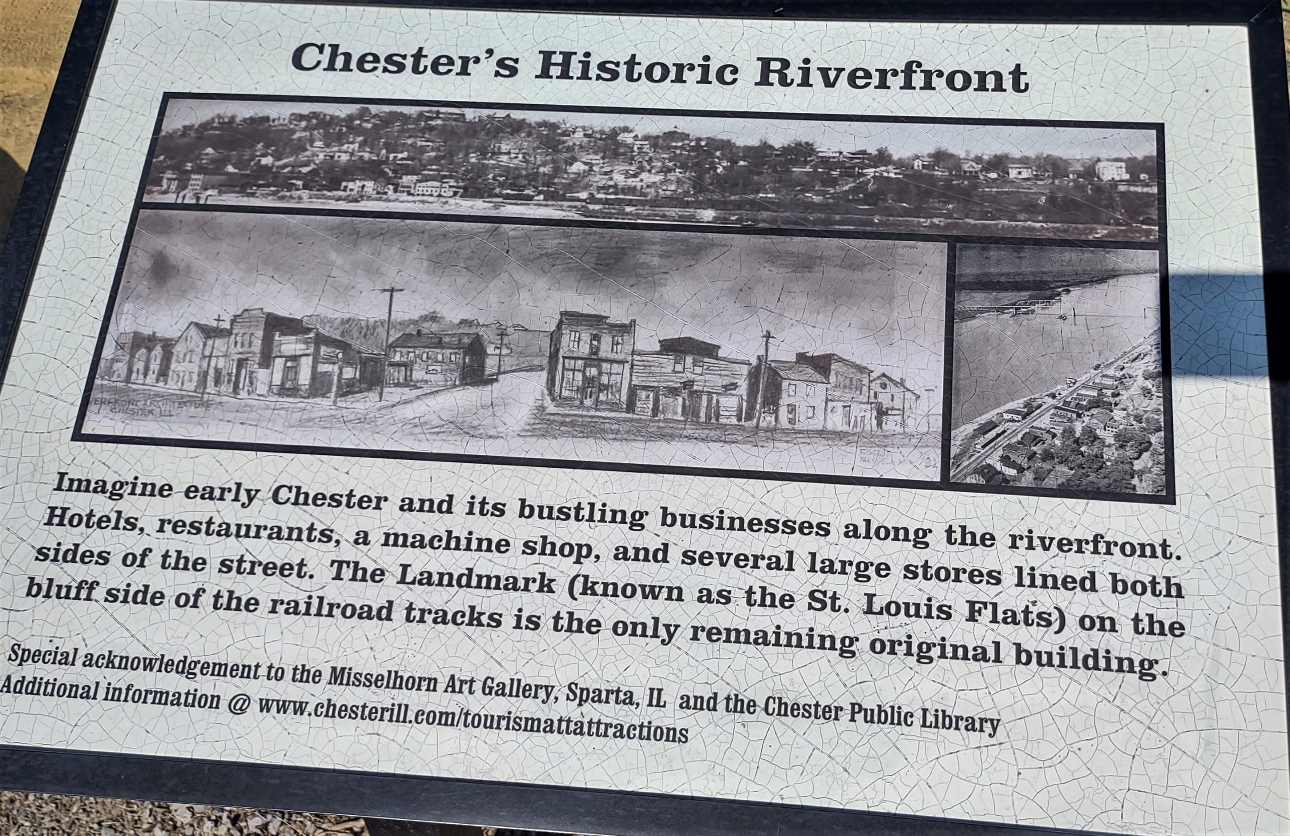
Chester Public Library’s companion exhibition examined the importance of the Mississippi in determining not only the historical trajectory of Kaskaskia but also that of Chester, which was established in 1829 in a somewhat less flood-prone location only a few miles downstream.[1] It featured numerous photographs and artifacts representing the steamboat era, when Chester’s economy revolved around river commerce, especially the transport of agricultural products, and its business district was situated along the waterfront.
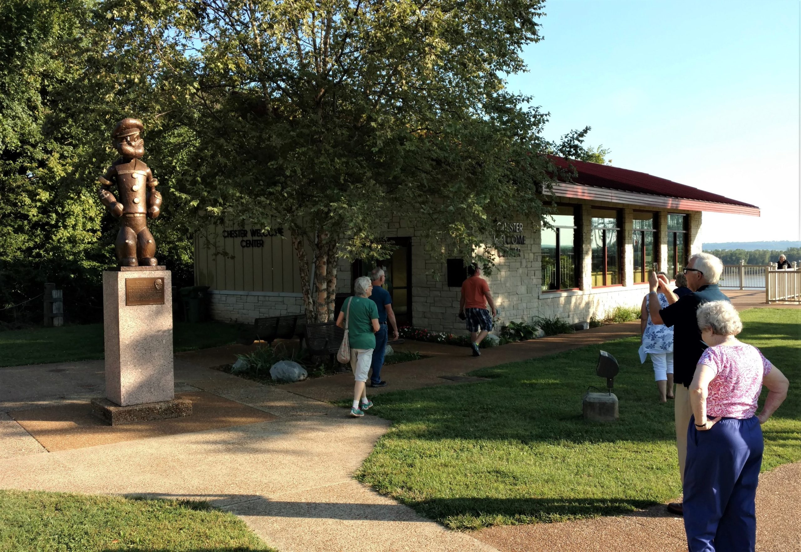
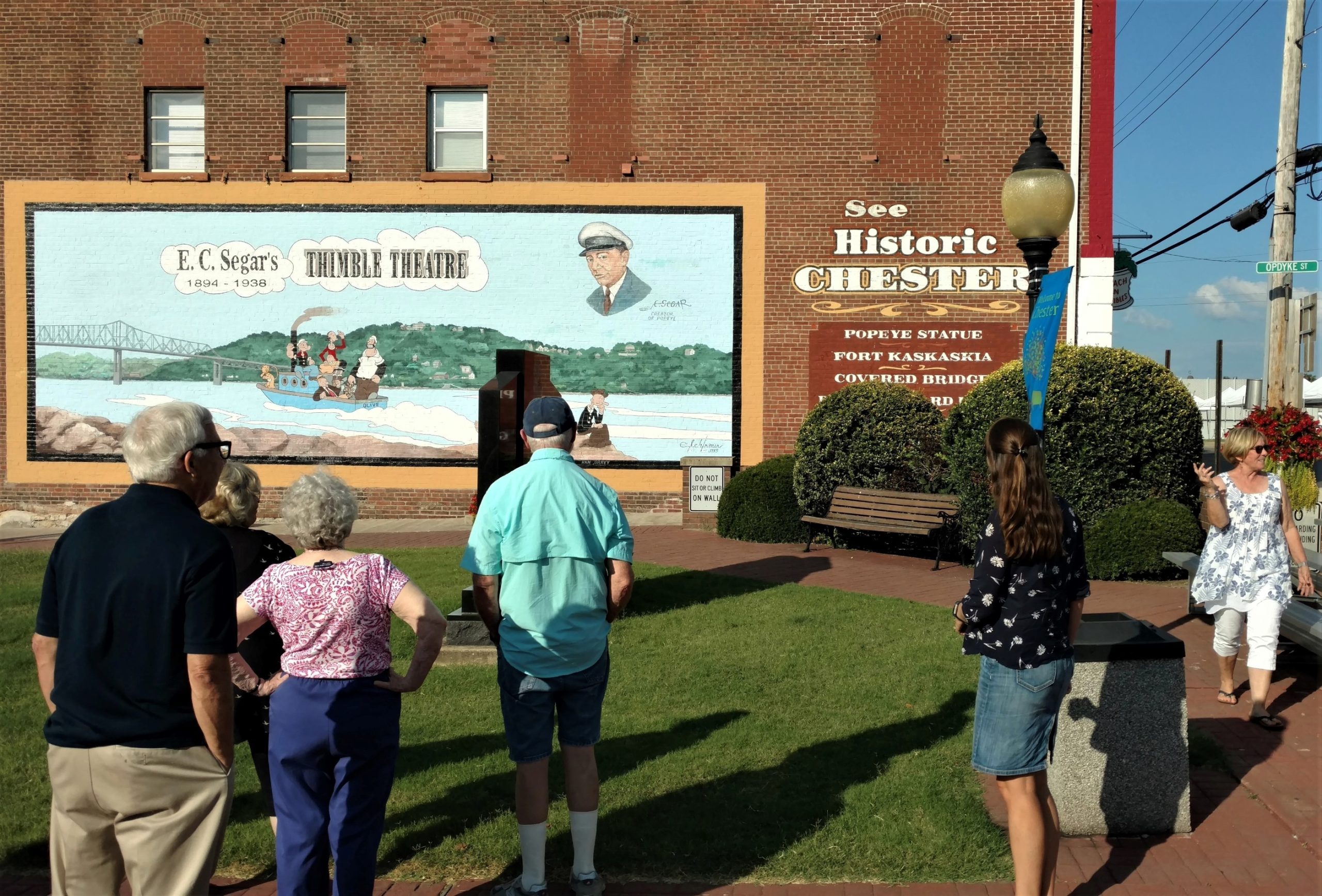
Initially, those products included castor oil, of which Randolph County was a major producer before petroleum derivatives supplanted it for many purposes.[2] In the 1920s, that plant-based lubricant became the namesake of the protagonist of a cartoon drawn by Chester native E.C. Segar.[3] Castor Oyl subsequently became a secondary character in another cartoon produced by Segar, the protagonist of which was inspired by Chester resident Frank “Rocky” Fiegel.[4] Chester celebrates its distinction as “The Home of Popeye” with the annual Popeye Picnic.[5] The opening of Crossroads in Chester coincided with the 2018 Popeye Picnic, drawing dozens of visitors from throughout the United States and beyond to view the exhibition.[6]
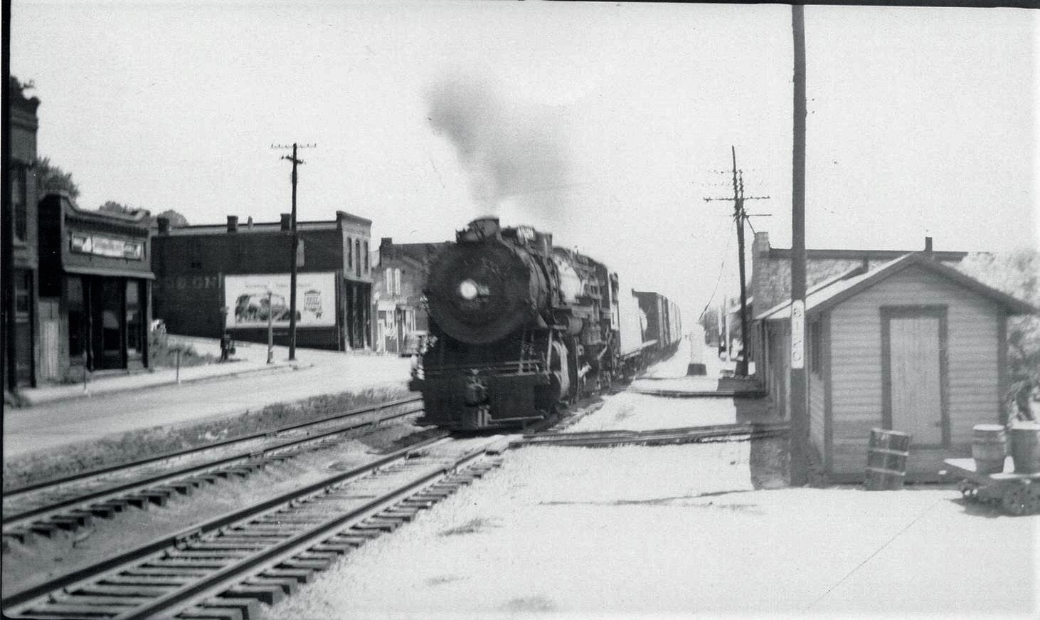
As railroads and highways diminished the importance of the river as a transportation route, Chester’s business establishments gradually migrated up the bluff and away from the river. (Some Chester residents still refer to the community’s central business district as “uptown” to distinguish it from “downtown,” the long-vanished commercial area on the riverfront.)
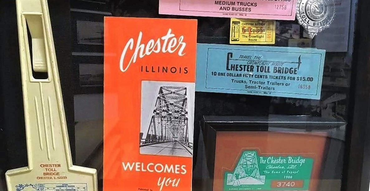
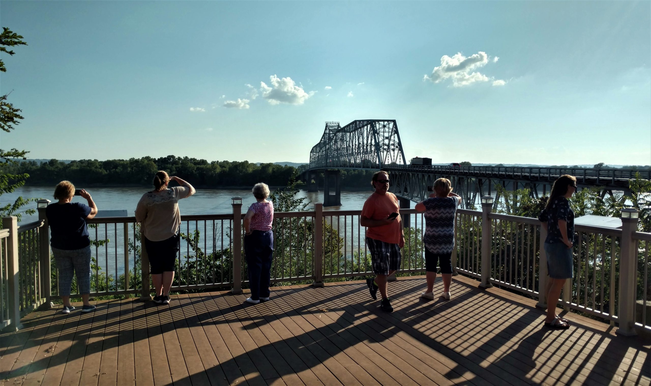
Nevertheless, the Mississippi remained significant in relation to transportation, as evinced by a segment of the library’s companion exhibition devoted to the construction of the Chester Bridge in the early 1940s. That bridge remains the only means of crossing the river’s main channel by road between the St. Louis area, almost sixty miles to the north, and Cape Girardeau, Missouri, approximately fifty miles to the south, playing a vital role in the economy of the Middle Mississippi Valley.[7] In September 2021, the Missouri Highways and Transportation Commission announced the allotment of funding in its Statewide Transportation Improvement Program budget for fiscal years 2022-26 toward replacement of the Chester Bridge, which it considers to be in poor condition.[8]
“The river does what it wants to do, and we as human beings make adjustments around that,” observed Brenda Owen, a volunteer with the library who curated much of its companion exhibition. “How the citizenry both in Kaskaskia and in Chester now adapt to those changes is what makes the difference.”[9]
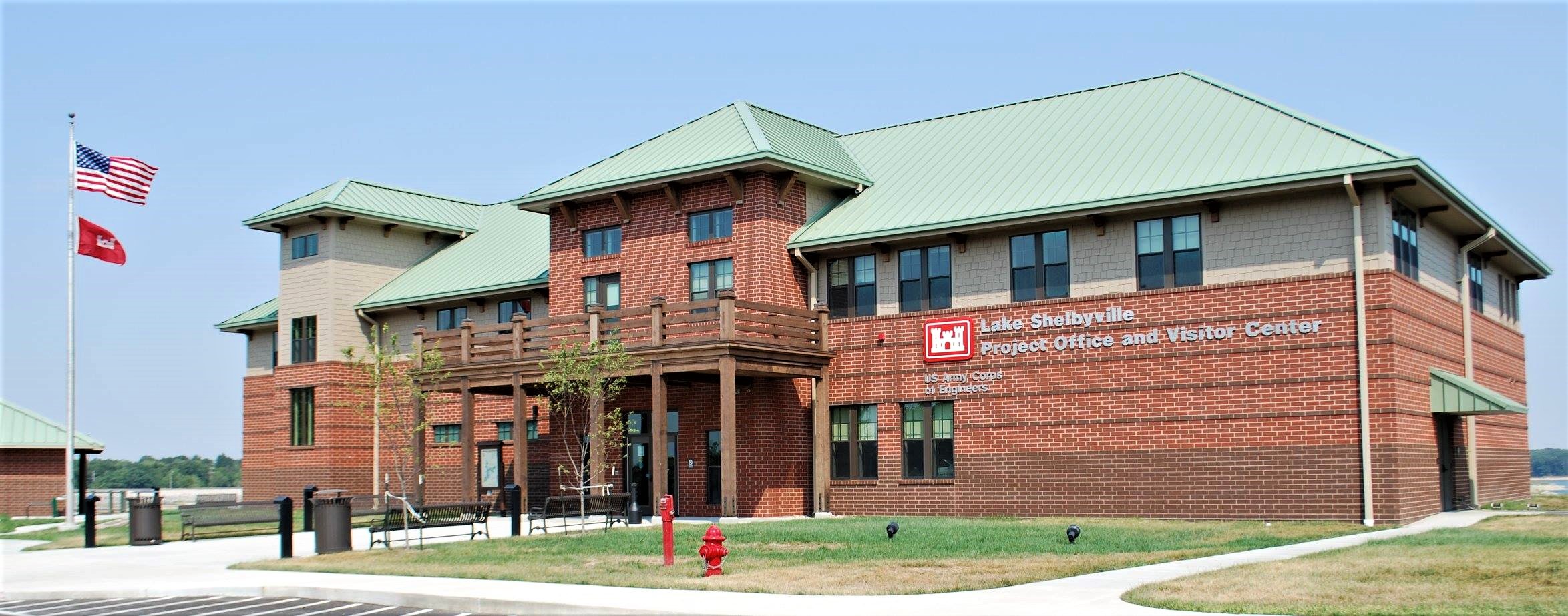
The other river along which Kaskaskia was situated before the cataclysm of 1881, the Okaw—now more commonly called the Kaskaskia River—connects Randolph County with another of the Crossroads: Change in Rural America host sites. Almost two hundred miles upstream, the Lake Shelbyville Visitors Center welcomes travelers to an 11,100-acre reservoir resulting from the damming of the Kaskaskia by the Army Corps of Engineers between 1963 and 1970.[10] The Visitors Center housed the exhibition in December 2018 and January 2019 in partnership with the Shelby County Bicentennial Committee.

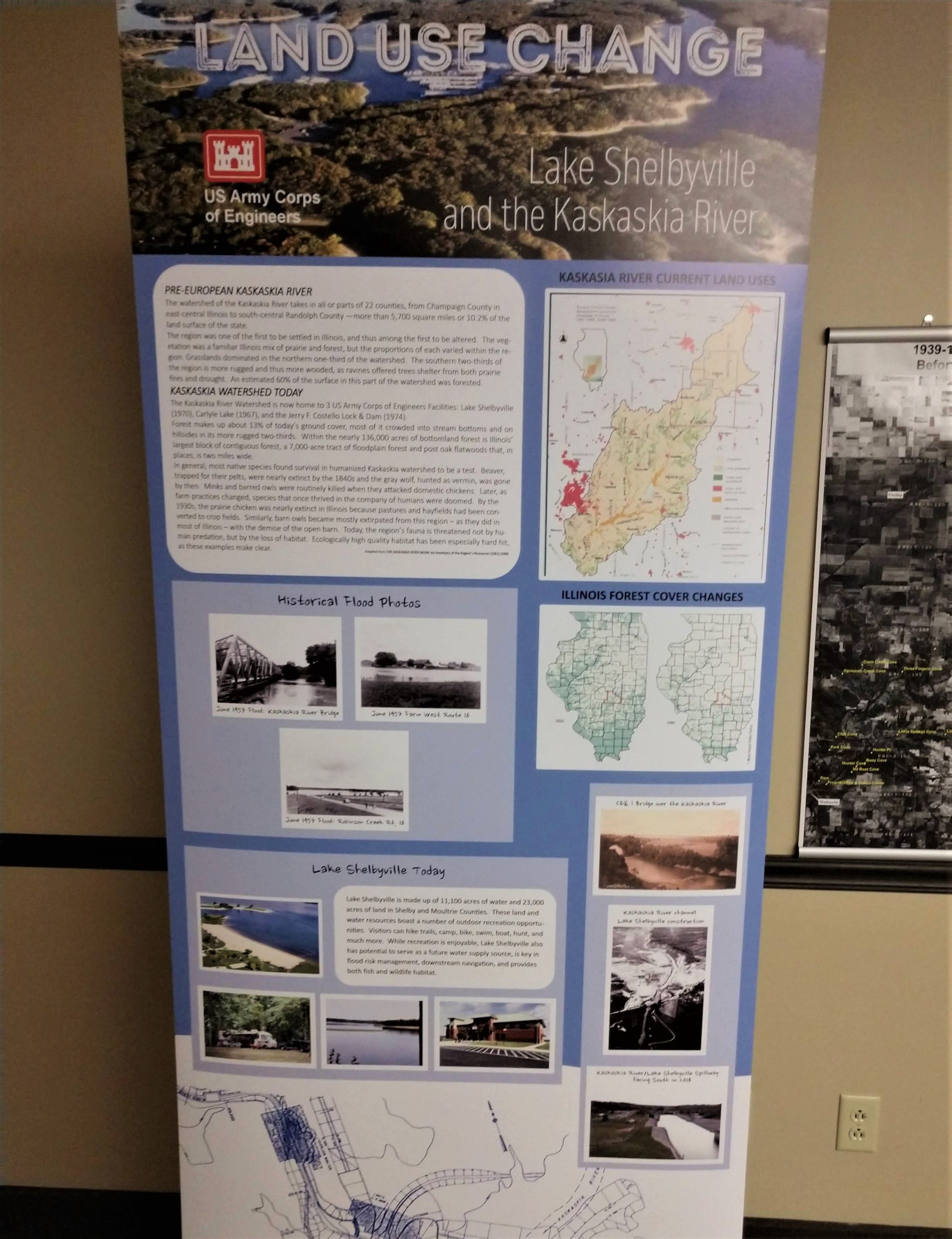
Using maps, photographs, and interpretive text, a section of the center’s companion exhibition illustrated the substantial long-term impact of the creation of Lake Shelbyville upon the ecology, economy, and culture of a large swath of rural east-central Illinois. The construction of Shelbyville Dam was intended primarily to control flooding along the notoriously capricious Kaskaskia River, a recurrent problem for farmers in Shelby and Moultrie counties in the mid-1900s, much as it had been for farmers around Kaskaskia more than a century before. (Two videos produced by members of the Corps’ St. Louis District staff in observance of Lake Shelbyville’s fiftieth anniversary—one available on Facebook and another on YouTube—illustrate and contextualize the building of the dam.)
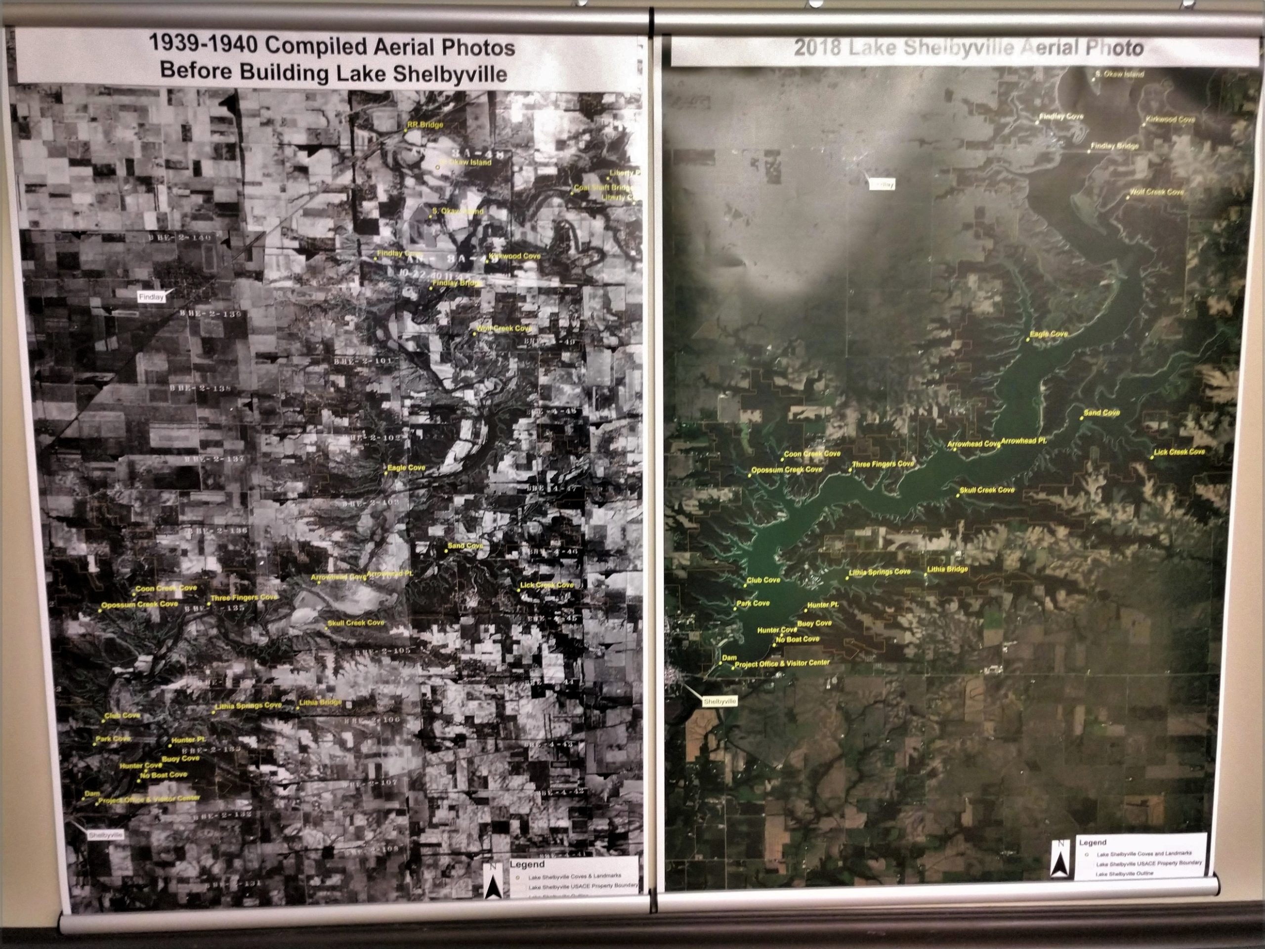
Not only was the dam largely effective as a means of flood control, according to the exhibition, it also provided a more extensive habitat for fish and wildlife and created a popular recreational tourism destination that generates revenue for the local economy, enhances the quality of life for residents, and aids in attracting and retaining businesses.
“I don’t think the lake gets enough credit, because water was the thing that could have finished us off with the flooding, small towns shrinking, railroads going away–and so the thing that saved us was Lake Shelbyville,” commented Freddie Fry, a member of the Shelby County Bicentennial Committee and director of the Shelby County Office of Tourism. “Not only did it make the farms that were left sustainable, but it brought us a new industry–tourism, recreation, ways to use other people’s money to help us move forward.”[11]

- Companion exhibition accompanying Crossroads: Change in Rural America, Chester Public Library, Chester, IL, September 8-October 20, 2018; “History of Chester,” City of Chester, IL (website), accessed March 25, 2023; Shane Wagner, Ghosts by the Riverside: The Haunted History of Chester and Old Kaskaskia (Chester, IL: Chester Public Library, 2019), 22. ↵
- “History of Chester,” City of Chester, IL (website). ↵
- “Castor Oyl,” Popeye the Sailorpedia, https://popeye.fandom.com/wiki/Castor_Oyl, accessed March 25, 2023. ↵
- Frank “Rocky” Fiegel, Popeye the Sailorpedia, https://popeye.fandom.com/wiki/Frank_”Rocky”_Fiegel; Dan Hubble, “Chester Man Accepted as Real-Life Popeye Was a Brawler, Loved Kids,” The Southern Illinoisan April 8, 1979, 33. ↵
- 2020 and 2021 were exceptions. The Popeye Picnic was canceled in 2020 because of the COVID-19 epidemic and in 2021 because of a disagreement between the picnic committee and the mayor’s office: Dan Zobel, “Well Blow Me Down, Popeye Picnic Canceled Over Controversy,” County Journal (Percy, IL), June 24, 2021, 1, https://countyjournal.org/june242021.pdf. ↵
- Tammy Grah, Brenda Owen, and Carolyn Schwent, telephone interview with author, October 22, 2019. ↵
- “Chester Bridge,” City of Chester, IL (website), accessed March 25, 2023; “Chester Bridge,” Missouri Department of Transportation (website), https://www.modot.org/chesterbridge, accessed March 25, 2023; Companion exhibition, Chester Public Library. ↵
- “Bridge Repair,” City of Chester, IL (website), https://web.archive.org/web/20220707155422/https://www.chesterill.com/uncategorized/bridge-repair-coming-up/, accessed September 25, 2021; “Chester Bridge,” Missouri Department of Transportation (website). ↵
- Tammy Grah, Brenda Owen, and Carolyn Schwent, telephone interview with author), October 22, 2019. ↵
- “Lake Shelbyville,” US Army Corps of Engineers’ “Corps Lakes Gateway” (website), accessed March 25, 2023; “Lake Shelbyville: 50 Years and Other Numbers,” Herald & Review, August 6, 2020, https://herald-review.com/news/local/by-the-numbers-50-years-since-lake-shelbyville-became-a-reality/article_734037c6-bf4c-560c-9a55-fe3c39eb5260.html. ↵
- Brenda Elder and Freddie Fry, telephone interview with author, October 1, 2019. ↵
